We are seeing some progress towards achieving environmental protection and management of bushland in the catchment of Narrabeen Lagoo but there are still large areas of bushland in the catchment containing threatened ecosystems and species that need a more permanent level of protection from encroachment or destruction.
Reading the president’s reports from each of our Annual General Meetings will give you an insight into how we have been working as a community group to protect the catchment.
We are approaching the bushland issues in several different ways – working with State and local governments, writing submissions, sending letters and lobbying for:

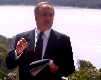
On 13th April, 2005, Warringah Council hosted a forum to discuss the future of Narrabeen Lagoon and its catchment.
Minister for the Environment, The Hon Bob Debus, MP, and Minister for Lands, The Hon Tony Kelly,MP, issued a joint press release(20kb pdf file) the first sentence of which reads “The catchment of Sydney’s largest coastal lagoon – home to a rich array of plant and wildlife species – should be protected forever, a State Government study has revealed.“
The Hon Bob Debus, MP, was the first speaker at the forum and in his speech (43kb pdf file), Minister Debus, MP, promised that 446ha of the Crown Land between Cromer and Belrose will be Protected Forever. As of Aug 2008, this promise has not yet been fulfilled satisfactorily.
20050413 Debus media release In August 2006, the Oxford Falls Regional Crown Reserve (192kb pdf file) was gazetted. This incorporates approximately 546ha of Crown Land and the Management Strategy document states that about 75% of this “is intended to be managed primarily for environmental protection”. This equates to 409ha which is less than what was promised by Minister Debus in 2005. A Regional Crown Reserve is not a permanent form of protection because the Dept of Lands can at any time put a small advertisement in the newspaper and degazette the land out of the Reserve. It does not need to go through a Parliamentary process.
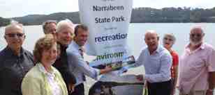
April 1, 2014 – Narrabeen Lagoon State Park was declared comprising the Lagoon itself plus Jamieson Reserve. There are other parcels of land that are being considered as additions to this initial Narrabeen State Park.
May 2017 – 140ha of extra land was added to the Narrabeen Lagoon State Park.
Local Members of Parliament, Rob Stokes,MP, Jonathan O’Dea, MP, and Brad Hazzard, MP, have been asking questions in parliament and writing letters to Minister Kelly and Minister Firth asking for the promised permanent environmental protection to be put in place, e.g. here is a question asked in June 2007 by Rob Stokes, MP (14kb pdf file), concerning adding crown land to Garigal National Park.
In October 2007 in Parliament, Sylvia Hale asked a question (14kb pdf file) of Minister Kelly (MInister for lands) and his answer indicated that preparation of a Plan of Management for the Crown Land would begin early in 2008 and that no decisions on land use would be taken until that process was complete. However, as of August 2008, the Management Plan process has not begun and yet one parcel of land has already been degazetted and sold. We want to know in what way the proceeds from that sale are to be applied to management of the remainder of the Crown Land because the Management Strategy document for the Oxford Falls Crown Reserve indicates that economic management would entail using the proceeds from income earning lands to fund management of the rest of the Reserve.
In March 2005, Dept of Lands issued their Final Assessment of the Crown Lands (738kb pdf file) between Cromer and Belrose. This Final Assessment is a one page document with a map attached with no explanations of the rationale for changing the mapping areas from the initial assessment through to the final one. There are lands added to this assessment that were not in the initial one and there are lands from the initial one missing from the final one. Although “environmental protection” was the first listed use for all of these lands, the way was left open for other uses such as “urban expansion”. The accompanying map showed areas for environmental protection coloured green but an orange/brown colour depicted large areas of “investigate disposal” lands.
Although the community has been promised a “place at the table” to discuss the future of these lands, as of Aug 2008, there has been no opportunity for any member of the community to sit down with staff of Dept of Lands with a map to discuss any of these lands. Dept of Lands has been discussing some of these lands with Warringah Council staff but not with members of the community.
Dept of Lands, as requested by a unanimous vote of Warringah Council in 1999, assessed the corwn lands from Cromer to Belrose and published their draft assessment of Crown Lands (3845kb pdf file) for public comment in December 2003. This draft assessment recommended environmental protection for the majority of the Crown Land in the catchment.
Narrabeen Lagoon Catchment was listed as an “indicative place” on the National Heritage Register before that register was frozen in 2006. In 2006, the Environment Protection and Biodiversity Conservation Act 1999 (the EPBC Act), and the Australian Heritage Council 2003 were amended to, among other things, freeze the Register. Places may now be protected under appropriate States, Territories and Local Governments heritage legislation.
There has been action from National Parks Association and other organisations working with Members of Parliament over many years to have the bushland of Narrabeen Lagoon Catchment protected in a National Park. An example of these actions is a proposed “Garigal National Park extension bill -1992”. Independent Terry Metherell, MP, gave an inspiring speech (57kb pdf file) in support of this bill.
Friends of Narrabeen Lagoon Catchment have written submissions in support of Warringah and Pittwater Councils and subsequently for the amalgamated Northern Beaches Council for initiatives such as:
1. Wildlife corridors to assist movement of animals and seeds from one area of core bushland to another
2. Plans of Management for all areas of bushland. These Plans recognise the value of the biodiversity provided by bushland areas and define the ways to provide sustainable management of them.
3. Plans of Management for Creeks and riparian zones.
4. Mapping of constraints to development (279kb pdf file) in bushland areas.
5. Provision of Development Controls and Local Environment Plans to limit encroachment of urban expansion into bushland and riparian zones.
6. Plan of Management for Narrabeen Lagoon
7. Narrabeen Lagoon multi-use pathway
8. Planning towards 2040
9. Housing strategy
10 The Bicycle Plan

When listening to authorities such as DECC, Dept of Lands and Warringah Council discussing the Crown Lands along the edges of Wakehurst Parkway, it became apparent that managing Middle Creek was a huge problem – particularly because of the level of weed infestion.
These weeds have probably flourished because the catchment of Middle Creek has been rural – with nutrient runoff from farms flowing down the creek and because urban development in the upper catchment has resulted in sediments and nutrients entering the creek. The implication was that providing permanent environmental protection for this area was too difficult because of these management challenges.
Friends of Narrabeen Lagoon Catchment worked with staff of both Warringah and Pittwater Councils to prepare an application for funding from the State Government for catchment education and for rehabilitation of three creeks in the catchment – Middle, Mullet and Nareen.
This application was successful and the Narrabeen Lagoon Catchment Project began in 2007 and operated until mid 2011. Management Plans for Middle, Mullet and Nareen Creeks are now in place.
Bush regeneration contracts have taken place for Middle, Mullet and Nareen Creeks.
The Narrabeen Lagoon Catchment Project provided crucial community education about living in the catchment – reaching out to schools, community members and businesses living and working in the catchment.

To assist people to appreciate the amazing asset we have in Narrabeen Lagoon and its catchment, Friends of Narrabeen Lagoon Catchment organise many low impact outdoor activities. We have also assisted those who have been lobbying for completion of a walkway around the Lagoon for all to share.
We support Warringah Council in their preparation of the multipurpose Trails policy and the Bike Policy but we want to see activities in bushland properly managed. As of August 2011, there are serious erosion and pollution problems being caused by 4WD vehicles, trail bikes, horses and constructions by mountain bike riders.
Establishment of organisation with mission statement to work for environmental protection for the remaining bushland in the catchment of Narrabeen Lagoon. Application made for Urban Sustainability Grant. First Road Kill mitigation seminar held.2006 – First report (12k pdf)
Urban Sustainability Grant of $1.9m announced at our first Forum. The grant is to be administered by Warringah and Pittwater Councils. The grant is for on-ground remediation of three creek lines plus Narrabeen Lagoon catchment sustainability education. Newsletter program established.Launched a series of bushwalks, tag-along tours and Eco-Paddles to raise awareness of catchment issues.2007 – Second report (24k pdf)
Met with local, State and Federal politicians to lobby for environmental protection of Narrabeen Lagoon catchment bushland. Survey of 400 residents confirmed that bushland and beaches are the most valued attributes of this area. Over twenty submissions written by the committee concerning environmental issues in the catchment.Work commenced that is funded by $1.9m grant. Activities are attracting large numbers of people and raising awareness of catchment issues.2008 – Third report (15k pdf)
Continued dialogue with local, State and Federal politicians to lobby for environmental protection of Narrabeen Lagoon catchment bushland. Regional Park idea proposed. Planning minister placed a 10yr moratorium on four large development applications in the catchment. Fifteen submissions written by the committee concerning plans for the catchment. We continue our involvement with the work funded by the $1.9m Urban Sustainability Grant. Organised four public Forums. Outdoor activities continue to appeal to large numbers of people and raising awareness of catchment issues.2009 – Fourth report (25k pdf)
Catchment Ambassador program announced. State Park concept proposed and endorsed by three local State politicians. Four forums held – one of which attracted 230 people so we needed to use two halls. Looking for funding to continue the remediation program after the $1.9m funding finishes in 2011. Assisted with production of a DVD entitled “Caring for our Catchment” which was launched at our February forum. Twelve submissions written including one about a proposal for a large retirement village in Oxford Falls.2010 – Fifth report (20k pdf)
forums held – all candidates for State Government support establishing Narrabeen State Park. End of program funded by $1.8m grant but Warringah Council gains other grants for bush regeneration to continue. Narrabeen Lagoon walkway progressing well. Action is needed on dredging the Lagoon for recreational use. Many submissions have been written on behalf of this organisation on issues in the catchment. Outdoor activity program continues to be popular. Changes in the membership of the committee.2011 – Sixth report (133k pdf) Four
Four forums held, regular newsletters, updated website, interesting outdoor activity program, new members on the committee, financial situation robust but wanting larger amount in case needed for defending the catchment, many submissions written, frustration that Narrabeen State Park has still not been declared, dredging of the lagoon a major issue.2012 – Seventh report (180k pdf)
Steady achievement with forums, outdoor activities, submissions, newsletter, website and financial position secure. Exciting proposal for Gai-mariagal Aboriginal Owned National Park which we support in addition to Narrabeen State Park.2013 – Eighth report (166k pdf)
Gai-mariagal Aboriginal owned National Park has been proposed by Metropolitan Local Aboriginal Land Council and we support this in every way we can. The proposal includes over 1000ha of bushland to be protected. Narrabeen State Park was announced in April 2014 and if the Gai-mariagal proposal fails for any reason, the State Park can be expanded to protect crown lands in the catchment. Narrabeen Lagoon Circuit walkway is progressing – due to open at the end of the year. Jim Somerville sadly passed away before it was complete – his campaign to have fences to protect pedestrians on Narrabeen Bridge was successful. The Dredging forum attracted a huge crowd – but probably the dredging won’t happen – instead the water level may be raised. Our finances are in good shape. Tony Carr stands down as president and nominates Judith Bennett.2014 – Ninth report (75k pdf)
Sad to report the passing of Mary Armstrong, a valued committee member. Thanks to Conny and Tony for the outdoor activity program. Forums have included a talk about bugs and beetles, reports from the World Parks Congress and Aboriginal activities (audience participation). We organised a successful Clean Up Australia event and some of our members helped with a Frog and Reptile study. Our committee members have continued to lobby for environmental protection of the catchment. The Narrabeen Lagoon Circuit Walk opened and is proving very popular.2015 – Tenth report (214k pdf)
We have conducted four forums, the topics being Catchment Management, Climate Change, Threatened Animals and Aboriginal Arts and Crafts. We also worked on Clean Up Australia Day around Narrabeen Lagoon walkway – special thanks to Marie Quinn for organisation on that day. Thanks to Conny and Tony for the outdoor activity program.2016 – Eleventh report (190k pdf)
Farewell to Phyll Morris. We conducted four forums – Narrabeen Lagoon State Park, Threatened animals in the catchment, Aboriginal Caring for Country, Meet the candidates for Local Government elections. We conducted the Spring Festival in 2016 offering 40 activities over two weeks, Committee members assisted with the Wheely Big Bushwalk in Dec 2016. Marie organised our involvement with Clean Up Australia in March 2017. We have conducted a regular program of outdoor activities thanks to Tony and Conny. We have written letters and submissions and met with decision makers at State and Local Government levels.2017 – Twefth report (122k pdf)
Our four forums have been – Amphibians and Reptiles, Protecting Powerful Owls, Local Aboriginal History and Creeks in the Catchment. The committee members have speakers and catering at forums, maintained financial and membership records and conducted outdoor activities in addition to writing letters and submissions, speaking at Land & Environment Court Hearings and meeting with decision makers.2018 – Thirteenth report (120k pdf)
Judith is seeking to step down from being president and instead become the secretary. Ron is willing to be nominated as President. Our four forums have been on Transport impacts in the catchment, Possums and Gliders, Aboriginal Heritage and Planning for the Future. Members of the committee have been alert to issues that impact the bushland in the catchment of Narrabeen Lagoon and we have written letters and submissions, spoken at hearings and met with decision makers in addition to organising forums and outdoor activities. Thank you to all committee members.2019 – Fourteenth report (112k pdf)
The year of Covid-19 meant that this AGM was held online via Zoom. Ron Patton reported on our forums (Northern Beaches Council towards 2040, Environmental aspects of roadworks near the hospital and along Mona Vale Rd, Secrets of the Catchment in 21st century) and outdoor activities for the year. He also told of the letters and submissions written by the committee and the presentations given by them at hearings. He anticipated that the next 12 months would be important for the preparation of planning documents that will guide the management of the natural environment for the foreseeable future.2020 – Fifteenth report (99k pdf)
Friends of Narrabeen Lagoon Catchment have been most concerned at the level of road kill in the catchment – particularly along Wakehurst Parkway, Mona Vale Road and Morgan Road.
Conny Harris and Jacqui Marlow embarked on a long term research project, plotting where each death occurred and recording which animals were killed. They also monitored which animals were using the culverts under Wakehurst Parkway to traverse from one area of bushland to another.
The results of this research are being used to instigate measures to reduce the road kill – firstly a fence has been erected between two bridges along Wakehurst Parkway and the culverts underneath are being studied to plot when animals go under the parkway safely.
Road kill in this area has sharply declined.

1949: Several nature conservation societies considered that the whole of the Deep Creek catchment and part of Middle Creek catchment had such great natural values that they should be protected in a Warringah National Park. However, the proposal was not approved because it involved the acquisition of so much alienated land NPA 1961).
1961: NPA proposal for a National Park in the Deep Creek – Narrabeen area. This was supported by the National Trust (NSW) and the Wildlife Preservation Society of Australia.
1968: The National Trust’s publication Sydney 2000 proposed the addition of the Deep Creek catchment to Ku-ring-gai Chase National Park.
1974: Northern Beaches Bushland Committee proposal for a Regional Natural Park in the Middle Creek – Deep Creek area. This was supported by the NPA, National Trust (NSW), Total Environment Centre and ten local associations and environment groups NBBC 1974).
1977: October. Collin C Donges and Associates (Consulting Town Planners and Surveyors, Landscape and Environmental Analysts, and Property Consultants) wrote to the NPA, National Trust (NSW), National Parks and Wildlife Foundation and the Wildlife Preservation Society to urge discouragement of development in the Deep Creek area and recommend its acquisition by the NPWS for nature conservation purposes (pers. comm. in NPA files 7.10.77).
1977: November. Submission from the NPA to the State Pollution Control Commission about the preservation and management of Narrabeen Lagoon (including the Deep Creek catchment) as a National Park or State Recreation Area, or preferably as an addition to Ku-ring-gai Chase National Park.
1984: The Metropolitan Local Aboriginal Land Council (MLALC) claimed about 500 ha in the Deep Creek catchment area.
1986: The National Trust (NSW), at the recommendation of its Landscape Assessment Committee, classified and entered into the National Trust Register the Narrabeen Lakes Western Catchments Landscape Conservation Area, including the area currently proposed for addition to Garigal National Park. The National Trust also recommended that Narrabeen Lakes and the catchment of Deep Creek be dedicated as a State Recreation Area centred on Narrabeen Lagoon.
1987: NPA proposal for reservation of the Deep Creek catchment. The southern boundary was the same as that of the 1995 proposal, although it extended east to Wakehurst Parkway incorporating the recreation reserve.
Late 1980s: After an unsuccessful bid by the land owner, Dainford Pty Ltd, to subdivide the catchment’s ridges for residential development, a land swap was agreed to whereby 95% of the freeholdings (about 900 ha) were obtained by the Government and vested in public ownership.
1990: April. Stage 1 of Garigal National Park (approximately 786 ha) was gazetted.
1991: April. The NPA announced that the proposed Garigal National Park was too small to be ecologically sustainable and should have included more of the Deep Creek catchment, adjacent crown land, Narrabeen Lagoon foreshores and the lagoon itself(NPA Press Release 6.4.91).
1991: April. The NPA noted that the Garigal National Park proposal appeared to be the first stage of a larger National Park and requested from the then Minister for the Environment (Mr Tim Moore) comments about possible further stages (pers. comm. in NPA files 15.4.91).
Early 1992: The Independent, Dr Terry Metherill, introduced to the Legislative Assembly a Private Members Bill (the Garigal Park Extension Bill 33kb .pdf) which was designed to bring the Park southward along the Wakehurst Parkway and incorporated the Manly Dam Reserve. However, the MLALC, which had already been granted approximately 200 ha in the vicinity and had made claims in 1984 for a further 58 portions totalling about 250 ha in the Oxford Falls area proposed by the Extension Bill, persuaded the Labor Party to vote against the Metherill Bill which was then defeated.
1992: April. Davidson State Recreation Area (of approximately 1200 ha and embracing most of Middle Harbour from North St Ives to Killarney Heights) was transferred from its Administrative Trust to the NPWS as an addition to Garigal National Park. The NPWS planned to include the vacant land to the south of the National Park.
1992: Stage 2 of Garigal National Park (including the former Davidson SRA) was reserved.
1993: June. Most of the proposed Stage 3 of Garigal National Park was granted to the MLALC. Although the NPWS had tried to prove their interest in the area prior to 1984 by using the NPA’s 1961 Deep Creek National Park proposal, the then Minister for CaLM (Mr George Souris) granted 57 of the Land Council’s claims, with no restrictions, against the advice of the NPWS who said the grants would prevent the gazettal of a reasonable southern boundary to Garigal National Park. One of the conditions of the Aboriginal land grant was that members of the MLALC would consult with the NPWS about a conservation agreement which would enable the latter to proceed with the planned southern extension (Stage 3) of Garigal National Park. By 1995 the MLALC had still not acted on this.
1994: February. An addition of 130 ha in one Portion was made in the north-east corner of Garigal National Park adjoining Monash Golf Course.
1994: June. The NPA emphasised to the Director General of the NPWS the need to add the 29 Crown Portions to the National Park and to pursue a conservation agreement with the MLALC for the 9 Aboriginal-owned Portions of 62 ha (pers. comm. NPA to NPWS 7.6.94). The NPWS desired such an agreement to ensure a sensible southern boundary and cover such items as fire and noxious weed control and were still attempting to negotiate with the MLALC.
1995: The State Labor Party claimed that it would gazette Garigal National Park additions (including Manly Dam Reserve) if elected in March 1995 (Carr 1995; Daily Telegraph Mirror 23.1.95 p.5).
1995: October. NPA proposal for Crown Lands and freehold additions to Garigal National Park in first edition of this report.
1999: January. Renewed NPA proposal for Crown Lands and freehold additions to Garigal National Park.
2004: January/February. Public comment was invited to the Dept of Lands assessment of crown lands between Cromer and Belrose. Department of Infrastructure, Planning and Natural Resources (DIPNR) is collating responses and a final determination of the preferred land use is under progress.
(Adapted in part from notes supplied by Jim Somerville, NPA Sydney Branch).
Friends of Narrabeen Lagoon Catchment
is associated with National Parks Association of NSW.